Shining Hill Secondary Plan – Overview
The
Shining Hill Secondary Plan provides the planning framework to guide the future development of a new residential community in southwest Newmarket. The Secondary Plan establishes a long-term vision, land use designations, and supporting policies to direct how the area will develop over time, including where housing, parks, streets, community facilities, and natural areas will be located. It forms part of the Town of Newmarket Official Plan and is implemented through future development applications such as plans of subdivision and zoning.
The Secondary Plan area is located west of Yonge Street, east of Bathurst Street, and north of the Newmarket–Aurora boundary, and encompasses approximately 83 hectares. Development is planned around a series of neighbourhoods supported by local centres that provide opportunities for community uses, small-scale commercial services, and connections to transit. A network of streets, sidewalks, trails, and cycling facilities is planned to support walking, cycling, transit use, and vehicle access throughout the community.
Environmental protection and sustainability are key components of the Secondary Plan. A significant portion of the plan area is designated as a Natural Heritage System to protect and enhance natural features and functions. The plan also includes policies related to parks and open space, housing mix and affordability, community facilities, transportation and mobility, urban design, and climate resilience. The Shining Hill Secondary Plan was approved in February 2026 following a multi-year study and public consultation process.
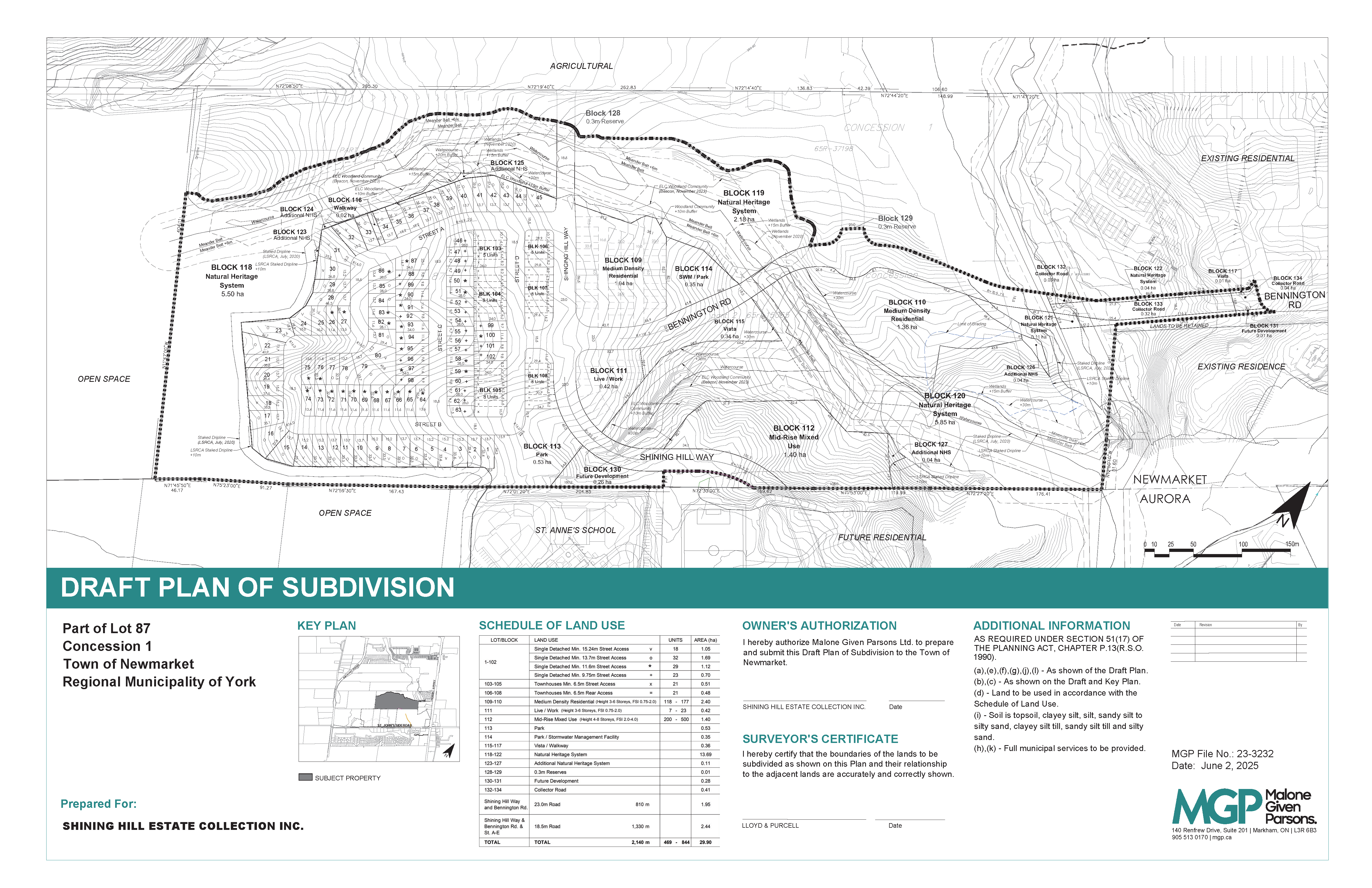
Draft Plan of Subdivision
To access the submission material, please visit our Current Application Map and click on the subject lands.